Santa Cruz Uses 3D Technology to Map Its Urban Forest
Published on October 27, 2026
Santa Cruz Uses 3D Technology to Map Its Urban Forest
Smart Tree Inventory documents trees along streets, in parks and at City facilities
SANTA CRUZ, CA — Santa Cruz is using laser scanning and high-resolution imagery to better understand its urban forest and track changes over time. Working with Davey Resource Group and technology partner greehill, the City’s Smart Tree Inventory covers street trees, park trees and trees at City-owned facilities in selected areas of Santa Cruz. The project areas were identified using environmental and community criteria, including vulnerability to environmental impacts and opportunities to benefit from urban forestry improvements.
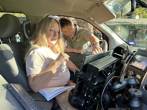
During the first week of October, a specially equipped vehicle scanned public streets and accessible park areas. LiDAR, short for light detection and ranging, uses laser pulses to create three-dimensional tree models documenting locations, trunk diameters, heights and canopy dimensions. Certified arborists review the measurements and imagery to assess tree characteristics and conditions.
“Federal grant funding is helping Santa Cruz use LiDAR technology to better understand our publicly owned trees along streets, in parks and at City facilities,” said Leslie Keedy, City Urban Forester. “This detailed picture of our urban forest will help us measure our tree canopy and guide tree care for years to come. We’re excited to have this funding opportunity and to work with Davey Resource Group to put the data to use.”
The inventory does not change property owners’ responsibility for maintaining street trees.
“Santa Cruz is showing what the future of urban forestry can look like by combining advanced technology with the experience and judgment of professional arborists. What makes this approach so exciting is its purpose: technology serving the trees, the people who care for them, and the community that values them,” said Anne Fenkner, Project Developer with Davey Resource Group.
The City shared the technology at an October 6 workshop at Harvey West Park, welcoming representatives from eight neighboring communities, local arborists and CAL FIRE to explore its applications.
Trees capture carbon dioxide, cool neighborhoods and help regulate water cycles. The inventory will inform the City’s climate and resilience goals, and plant 3,000 new trees by 2030 as specified in its Climate Action Plan 2030. Its 2025–2030 Local Hazard Mitigation and Climate Adaptation Plan also prioritizes tree planting in frontline neighborhoods as one of 27 projects to be implemented by 2030.
The inventory is supported by the City’s $1 million grant through the Urban Sustainability Directors Network (USDN), funded by the U.S. Forest Service’s Inflation Reduction Act Urban and Community Forestry Program.
The completed inventory will connect to the City’s existing tree inventory software, is expected to be ready for City use by the end of November and data will be used immediately.
Learn more at santacruzca.gov.